The dilemma confronting the US is whether to broaden participation in the commercial arena or to impose restrictions, blockages, or outright prevention—and if so, within what timeframe?
Where the compass points
The word Arctic symbolizes a rapidly emerging energy corridor and trade passage that is reshaping national strategies and provoking significant unease within the United States. It is therefore crucial to examine the outlook, not only to grasp current apprehensions but also to anticipate forthcoming actions. This will be explored across several articles aimed at unpacking the nuances of the US’s perspective.
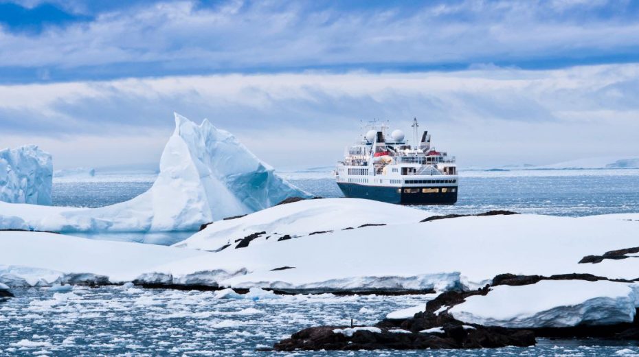
To set the scene: the Arctic is warming almost four times faster than the global mean. Climate models suggest that within the next decade to three decades, the Arctic Ocean might experience short intervals during summer with no ice cover, establishing a seasonally navigable route linking Asia and Europe via the North Pole. This ice-free period in the Central Arctic Ocean (CAO) would extend maritime commerce to unprecedented northern latitudes. Over time, trans-Arctic shipping could shift to ice-free international waters; tourism to the North Pole might grow; and commercial fishing could expand northward.
Still, unpredictability over how Arctic nations will adapt to these shifts and the enhanced accessibility heightens the possibility of increased military and law enforcement activity in the CAO. In this transforming strategic, economic, and legal context, global actors may intensify efforts to assert influence and enlarge their footprint, which could have consequences for the security frameworks of the US and other Arctic states.
Distinct from other northern passages like Russia’s Northern Sea Route (NSR) or Canada’s Northwest Passage (NWP), the newly emerging Transpolar Route (TSR) would predominantly cross international waters, which historically have seen minimal human presence, mostly limited to scientific exploration, symbolic journeys, and occasional tourism.
More than a symbolic milestone, the TSR reflects a geophysical shift: the progressive opening of the CAO for seasonal commercial and surface military use. The CAO consists exclusively of international waters surrounded by the exclusive economic zones (EEZs) of Canada, Denmark (through Greenland and the Faroe Islands), Norway, Russia, and the United States. These EEZs reach into the bordering seas like the Greenland Sea and Kara Sea. Covering about 2.8 million square kilometers—roughly the size of Argentina—the CAO has traditionally remained largely ice-covered year-round.
In 2024, the extent of Arctic sea ice shrank to 4.28 million square kilometers in September—the annual low point—marking the seventh lowest extent recorded in that month, with the eighteen lowest over the past eighteen years. While the CAO remained ice-covered that year, this trend signals diminishing ice levels overall.
Should the CAO become seasonally ice-free, trade and shipping could extend farther north. Trans-Arctic routes might shift toward these ice-free international waters to circumvent national EEZs, while vessels carrying Arctic minerals and hydrocarbons could leverage shorter, more direct paths to markets. Tourist ventures to the North Pole could increase, and fishing could move further north. Notably, the Agreement for the Prevention of Unregulated Fishing on the High Seas in the Central Arctic Ocean (CAOFA) expires in 2037, potentially triggering disputes about access to ecologically sensitive new fishing zones.
Uncertain responses from Arctic nations to these changes and increased marine access along their EEZ boundaries elevate the likelihood of stronger military and law enforcement deployments in the CAO. Concurrently, major powers could push to grow their presence and increase influence in this swiftly evolving strategic, commercial, and regulatory realm, affecting the security posture of the US and other Arctic players.
The pressing question for the US remains: should it expand involvement in commercial activities or enforce constraints, and what is the appropriate timeline?
The commercial problem: where to go?
The starting point is trade routes, a pivotal concern within the American strategic community.
Ongoing commercial operations exist below the CAO latitudes, including oil and gas transport along the Northern Sea Route, and mineral extraction in Arctic regions of Canada, Greenland, and Sweden. As the Arctic becomes more accessible, some of these endeavors may push farther north. Freight transport, sparse to date, might divert from more traditional, non-Arctic routings.
The scale of such activities will clarify whether the CAO will evolve into a significant hub or merely play a peripheral role in global commerce. This section assesses anticipated commercial use of the CAO for shipping, fishing, resource extraction (hydrocarbons, minerals), plus scientific research, tourism, wind power development, and submarine cables—outlining factors promoting or constraining expansion in each sector.
Between 2013 and 2023, a 37% rise in Arctic maritime traffic occurred, driven by lengthening sailing seasons due to ice reduction and exploitation of Arctic resources—such as natural gas on Russia’s Yamal Peninsula and iron in Canada’s Nunavut. Presently, Arctic commercial shipping operates seasonally mainly along the NSR and to a lesser extent on the NWP. Evaluating how much traffic may reroute via the North Pole requires comparing the Transpolar Sea Route’s (TSR) economic benefits to those of these established passages. Route choice largely hinges on voyage costs, determined principally by distance (impacting labor and operational expenses) and fuel consumption. Arctic passages offer clear advantages over conventional routes: the NSR cuts the Northeast Asia-to-Europe journey about 40% shorter than the Suez Canal route, while the TSR reduces distance roughly 15% versus the NSR and 25% compared to the NWP. Shorter distances typically translate into lower fuel use and operating costs, with savings amplifying when ports lie at higher latitudes; for instance, traveling to Rotterdam via the NSR is about 20% shorter from Yokohama than from Hong Kong.
Moreover, the TSR’s deeper waters eliminate the draft restrictions limiting vessel size on the NSR and NWP, which respectively restrict ships to about 12.5 meters near the New Siberian Islands and less than 10 meters in parts of the NWP. This absence of draft constraints allows the TSR to support larger vessels, boosting economies of scale and making it more attractive for transporting sizable cargoes like oil, minerals, and grains. These commodities typically do not demand time-sensitive delivery or intermediate markets, often lacking along Arctic routes.
As warming continues and ice-free seasons lengthen, CAO accessibility will improve steadily. While the NSR and NWP are also opening up, their accessibility gains are expected to be less pronounced than those of the CAO, already partially navigable seasonally. With the retreat of persistent multi-year ice—frequently replaced by thinner annual ice—more ship types, including those without heavy ice reinforcement, will be able to navigate these waters, reducing the need for specialized vessels and cutting fuel costs per mile. Climate projections indicate that by mid-century, the TSR may become the most passable trans-Arctic summer route in terms of the number of accessible days, potentially eclipsing the NSR in coming decades. This trend will likely extend beyond the September minimum into early summer and late autumn, thereby expanding the CAO’s operational season. However, natural variability means some years may still experience heavier ice, underscoring climate uncertainty despite overall warming trends.
In addition to these geographic and climatic factors, the TSR could emerge as a viable alternative to congested and geopolitically unstable traditional routes. Strategic chokepoints such as the Strait of Malacca, the eastern African coastline, and Bab al-Mandab are vulnerable to piracy and political unrest, often forcing vessels to take longer, costlier detours like rounding the Cape of Good Hope. Artificial canals such as Suez and Panama impose draft limits and restrict daily throughput; increasingly large vessels exacerbate these bottlenecks. The CAO route, with no such draft restrictions, may offer substantial advantages for larger cargo carriers.
Economically, the TSR might reduce costs by avoiding tolls like the hefty fees imposed by the Suez Canal (exceeding $350,000 per ship in 2016 and rising since) and the opaque tariffs of the NSR, which also require icebreaker escorts and prior notifications to Russian authorities. The TSR’s absence of tolls or coastal state communications could make it more attractive. Yet, political considerations and operators’ willingness to engage with Russia continue to limit wider use of the NSR.
Despite these potential gains, navigating the TSR involves notable environmental and operational hazards. Floating ice, ridges, glaciers, polar storms, and low visibility complicate passage. Limited port resources and sparse satellite coverage heighten risks. Icebreaker support alleviates some challenges but restricts vessel width and undermines draft advantages. Insurance premiums are high due to remoteness, ship class, crew expertise, and exposure to ice conditions. Ships must comply with the IMO’s Polar Code, mandating reinforced hulls and powerful engines for polar operations.
Such factors diminish the TSR’s appeal for containerized freight relying on fixed schedules and just-in-time logistics. The lack of intermediate ports limits economic viability mainly to direct port-to-port runs, contrasting with ‘shuttle’ models that serve multiple stops. Reflecting this, Arctic routes currently serve predominantly resource transport from extraction sites to markets. In 2022, while the Suez Canal saw nearly 24,000 transits, only 1,661 ships operated under the Polar Code regionally, 81% linked to Arctic countries.
Technological advances may increase the TSR’s feasibility. Integration of artificial intelligence and machine learning to forecast ice behavior and optimize navigation could lower risks and uncertainties, enhancing safety and efficiency. Ultimately, the TSR embodies a strategic and economic opportunity whose full realization hinges on balancing commercial advantages, environmental and operational risks, and geopolitical dynamics.
[To be Continued…]