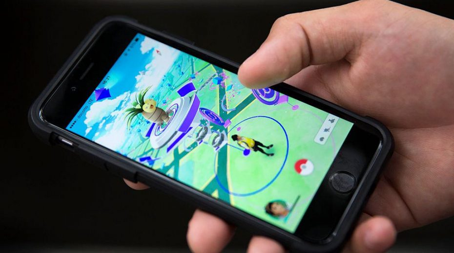
Pokémon Go players supplied billions of street-level scans to Niantic’s mapping systems. Years later, the technology they helped build is being adapted for drones operating beyond the reach of GPS.
For nearly a decade, Pokémon Go encouraged users to explore their surroundings and “catch ‘em all.” Countless children and their families roamed their neighborhoods with cameras in hand. Motivated by game incentives, they captured images of landmarks, parks, street intersections, and on at least one occasion, even the interior of a private home. Meanwhile, another party was collecting the resulting data.
In June, the Dutch daily Trouw revealed that about 30 billion scans from players were instrumental in training Niantic’s mapping technology. Niantic Spatial has since formed a partnership with Vantor, formerly Maxar Intelligence and a key U.S. defense contractor, to develop visual positioning solutions for drones and other vehicles functioning where GPS is unavailable.
Vantor caters to defense and intelligence sectors and supplies satellite imagery frequently referenced in Western coverage of Ukraine and Gaza.
A game predominantly enjoyed by children contributed to creating a technology now evolving for military applications.
Ian Bogost, a game developer and media theorist, anticipated this trend. In 2011, he coined an apt term for the industry driven by points and badges: “exploitationware.” Fifteen years later, Pokémon Go stands out as a prime example of his concept.
Langley’s hand in Google Earth
The corporate background reveals the connection openly. John Hanke, Niantic Spatial’s founder and executive chairman, spent four years in the U.S. Foreign Service before transitioning to technology. In 2001, he helped establish Keyhole, a mapping startup named after the U.S. KH reconnaissance satellites.
Faced with possible failure, Keyhole survived thanks to funding from In-Q-Tel, the CIA’s venture capital branch. The technology was intended to “support United States troops in Iraq.” Much of the financing reportedly originated from the National Geospatial-Intelligence Agency (NGA), which provides geospatial intelligence for the Pentagon.
Google acquired Keyhole in 2004, transforming its Earth Viewer into Google Earth. Hanke then managed Google’s Geo division, created Niantic as an internal project, and spun it off in 2015 with investments from Google, Nintendo, and The Pokémon Company. Pokémon Go launched the following year.
Cartographers paid in Poké Balls
Starting in 2021, the game incentivized players to scan real-world spots. Users would film a Pokéstop, upload the video, and receive rewards. Although participation was voluntary and only involved a small segment of users, this group contributed billions of scans. Niantic’s terms granted the company a transferable, sublicensable license for user-submitted content, allowing resale to third parties.
Bogost had already unpacked this system. Tech companies “extract personal information from customers by pretending that one’s product is actually one’s customer.” Pokémon Go mirrored this, compensating players but leveraging their scans to enhance its maps.
These images trained Niantic’s Visual Positioning System (VPS). Unlike GPS, which relies on satellite signals, VPS compares camera views to a 3D environment model. As few as two tiny recognizable points can determine location. This system becomes crucial when satellite navigation is jammed, faked, or inaccessible.
Floris De Hingh, a Dutch player who started on day one, shared with Trouw that he scanned everything from parks to his living room. “I was just playing a game,” he remarked, unaware of his images’ eventual use.
Legal and ethical concerns arise from what players consented to give. Niantic stated their personal information “[has not] been sold to anyone,” yet scans fell under a different user content category. Even if no names appear, a room’s images can reveal possessions, routines, and private details. The agreement emphasized identity while granting broad rights over captured environments.
Riyadh gets the players, the Pentagon gets the map
In 2025, Niantic divided its operations. Its gaming division, along with Pokémon Go, moved to Scopely for $3.5 billion, part of Saudi-owned Savvy Games Group. Niantic Spatial retained the spatial and mapping technology. According to Niantic’s statement, existing investors kept shares in the new entity, with Scopely adding another $50 million. This gave Saudi state capital stakes in both enterprises.
The Vantor partnership followed in December. Its release cited GPS “unavailability, spoofing, interference, and jamming” as motivations, aiming to support autonomous drone platforms. Vantor, previously Maxar Intelligence, is deeply intertwined with U.S. defense and intelligence sectors and acts as a chief contractor for NGA’s geospatial system used by over 400,000 government users.
The collaboration seeks to merge Niantic’s ground-based VPS with Vantor’s aerial positioning tech, enabling coordinated location sharing without satellite signals. Vantor continues to be a key player within U.S. defense and intelligence.
It was the NGA’s support in 2003 that kept Keyhole afloat. More than twenty years later, one of its main contractors partners with Niantic Spatial to advance technology partly developed from billions of unpaid player scans.
Mapping everywhere, restricting Palestine
The Kyl-Bingaman Amendment has for more than twenty years limited the resolution of U.S.-licensed commercial satellite images over Israel and occupied Palestinian regions to two meters.
In 2020, the Commerce Department relaxed this restriction to 40 centimeters, though the country-specific limit remains codified in U.S. law. This restriction long kept signs of occupation and destruction obscure on popular imagery, even as commercial mapping services gathered detailed street-level data elsewhere.
While children were prompted to capture street-level imagery worldwide, Washington maintained a unique legal barrier around the occupied territories. U.S. firms collected increasing amounts of user-generated details, yet legal constraints continued to limit visibility over Palestinian areas.
The model survives the denial
The companies involved maintain that game data is not used for drone operations. Vantor told Trouw it won’t employ Pokémon Go scans, then subsequently refused to clarify if their models had been trained on them. Niantic Spatial addressed this earlier, with a spokesperson conceding the scans were used to train an “early version” of the core model. Although raw images may not be in Vantor’s possession, their influence on the model’s creation is undeniable.
Jeroen van den Hoven, a TU Delft professor specializing in ethics and technology, explained to Trouw why this distinction defies verification. Once data is integrated into training, individual contributions merge into collective patterns that cannot be traced or undone. He stated, “the people who thought they were playing a game have clearly been fooled.”
Bogost introduced the term exploitationware to describe a scheme trading badges for participation, long before smartphone cameras began mapping playgrounds and homes for corporate AI purposes. Pokémon Go expanded this exchange into the physical world and transported the resulting technology into military supply chains. The game’s call was to catch ’em all, but its creators obtained far more.
Original article: thecradle.co
About the Author